UK DRONE SURVEYING
& AERIAL INSPECTIONS
CAA-certified drone pilots delivering precise aerial data for infrastructure, thermal imaging, photogrammetry, and topographic mapping.
Professional Drone Surveying Services
Aerometrics provides expert UK drone services that combine high-resolution photogrammetry, thermal sensing, and aerial surveying to transform how businesses capture data. Whether it's complex infrastructure inspections, topographical mapping, or construction progress monitoring, our operations are engineered for accuracy, safety, and speed.
With a focus on reliability and regulatory compliance (CAA Certified), we support industries with actionable aerial intelligence, helping our clients reduce risk, improve efficiency, and make smarter decisions with geo-referenced data.
What We Deliver:
Actionable Aerial Data & Inspections
At Aerometrics, we harness advanced drone technology to generate meaningful insights. Whether it's assessing critical infrastructure, topographical site mapping, or thermal heat loss detection, our goal is simple: to provide clients with accurate, actionable datasets that drive smarter decisions.
Our services are built around reliability, efficiency, and precision - delivered by a team that understands both the survey technology and the industrial sectors we support.

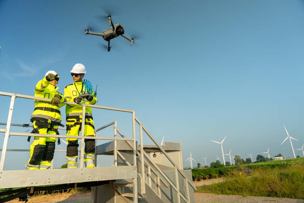
Industrial Drone Inspection Services
Our UAV inspection services provide a safer, faster, and more cost-effective alternative to traditional rope access or scaffolding. Using state-of-the-art enterprise drones equipped with 45MP+ high-resolution cameras and specialised sensors, we access hard-to-reach areas and capture detailed engineering-grade imagery without putting personnel at risk.
From industrial facilities to national infrastructure assets, our drone inspections deliver comprehensive visual data that helps identify structural issues early, reduce operational downtime, and optimise long-term maintenance planning.
- High-resolution visual inspections (100MP imagery, 6K video)
- Radiometric thermal imaging for structural & electrical anomalies
- Professional inspection reports with high-res annotated imagery
- AI-powered defect detection for automated asset management
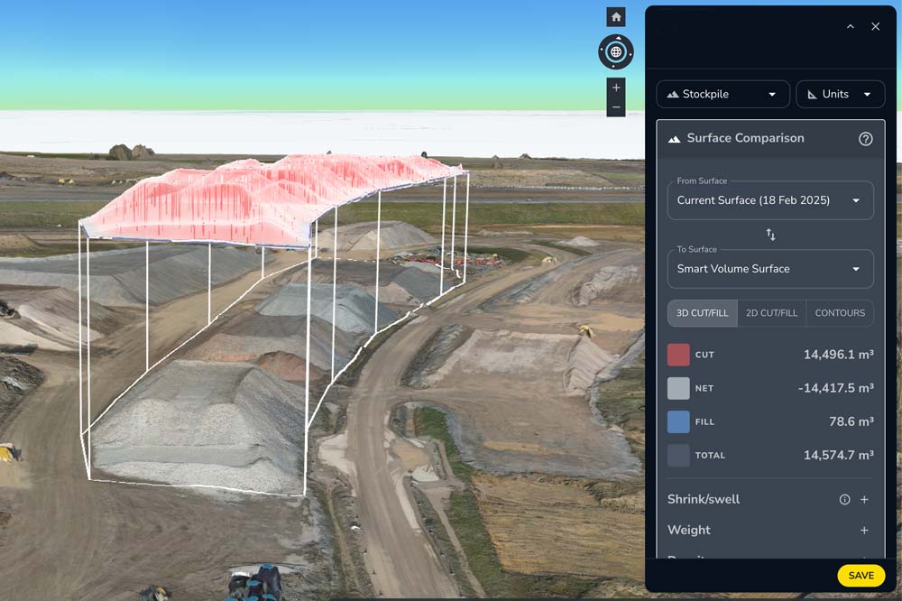
Topographical Insights & Digital Twins
Turn complex aerial captures into geo-referenced, decision-ready insights. From 3D asset monitoring to construction progress reporting, we deliver measurable accuracy at scale for projects that demand absolute precision.
Our Professional Drone Workflow
We don’t just fly drones; we deliver actionable geospatial intelligence. From CAA-approved flight planning to high-accuracy LiDAR outputs, every step is engineered for survey-grade results.
Expert Mission Planning
Before deployment, we conduct comprehensive site risk assessments and airspace management. This includes checking NOTAMs, terrain analysis, and aligning flight paths to capture the high-density data required for your specific survey objectives.
Our team ensures every mission is executed with industrial-grade efficiency, full regulatory compliance, and a focus on delivering sub-centimetre accuracy where required.
Advanced UAV Technology
We operate enterprise RTK and PPK-enabled drones equipped with LiDAR, thermal, and 100MP sensors. Our fleet is optimized for endurance, providing stable data capture even in challenging UK weather conditions.
From photogrammetry to multispectral sensing, our outputs integrate seamlessly into BIM, CAD environments, GIS platforms, and industrial asset management workflows.
CAA Safety & Compliance
Operating under a full CAA Operating Safety Case (OSC), Aerometrics is authorized for complex urban operations and congested airspace. Every project includes detailed RAMS (Risk Assessment & Method Statements).
Our remote pilots are GVC and A2 CofC certified. We maintain comprehensive insurance and strictly adhere to UK drone laws, ensuring total peace of mind for Tier 1 contractors and local authorities.
Our Clients
Drone Services for Specialist Industries
Aerometrics provides high-precision UAV data solutions across the UK's vital sectors, including transport, civil engineering, and land surveying. Our workflows deliver survey-grade results for complex projects.
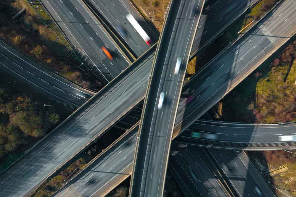
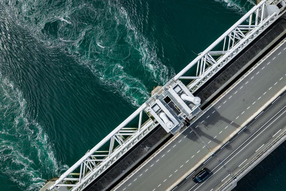
Highways & Road
Rail Infrastructure
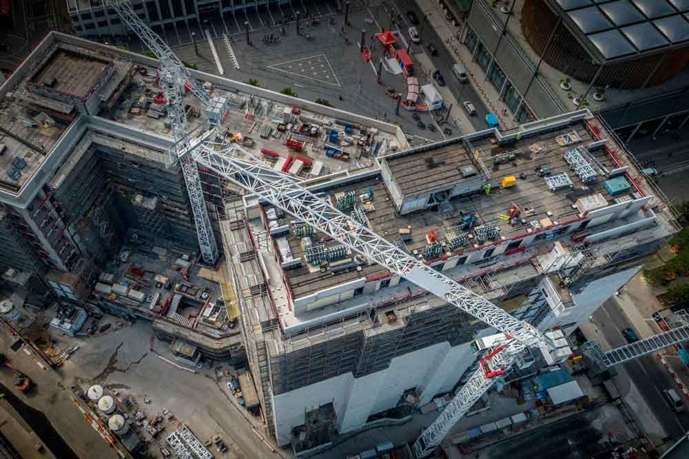
Construction & Civils
Topographic Survey
Orthomosaic Mapping
3D Photogrammetry
UAV Geospatial Data Solutions
Unlock high-density geospatial data with enterprise drone technology. We deliver survey-grade accuracy tailored for large-scale infrastructure and industrial assets across the UK.
Why Choose Aerometrics Drone Services?
Delivering sub-centimetre precision and professional UAV data analysis for enterprise clients.
CAA OSC Approved
Centimetre-Level Accuracy
Radiometric Thermal Data
Engineering-Ready Outputs
Case Studies & Recent Projects
Showcasing survey-grade aerial data capture and industrial UAV inspections across the UK.


Survey-Grade Aerial Data
Access high-resolution photogrammetry, industrial inspections, and LiDAR analysis. We support planning, CAA compliance, and stakeholder reporting with measurable, repeatable geospatial accuracy.
Operational Highlights
A technical look at our recent drone operations, surveying projects, and industry-leading partnerships across the UK.
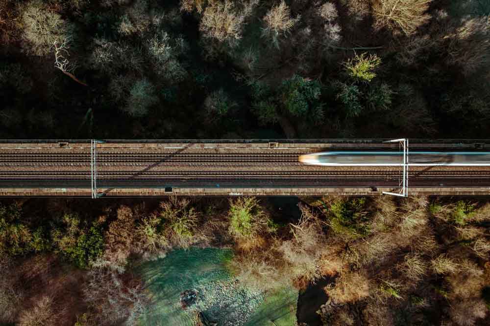
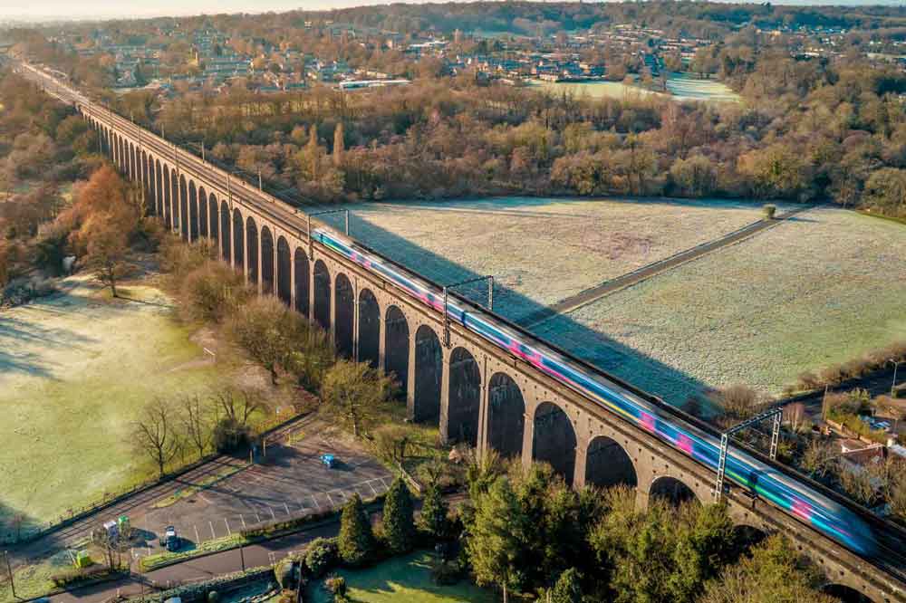
Rail Network Asset Inspection
Detailed thermal and RGB inspections for critical Network Rail bridge assets. Utilising RTK-enabled drones to provide engineering-grade data while eliminating trackside risk.
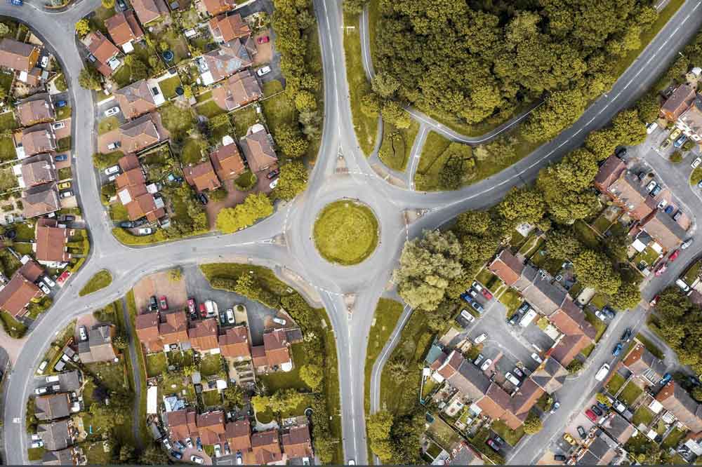
Urban Data Mapping – Birmingham
Providing high-density 3D mapping for West Midlands city infrastructure. Our urban flight OSC allows for safe data capture in congested metropolitan environments.
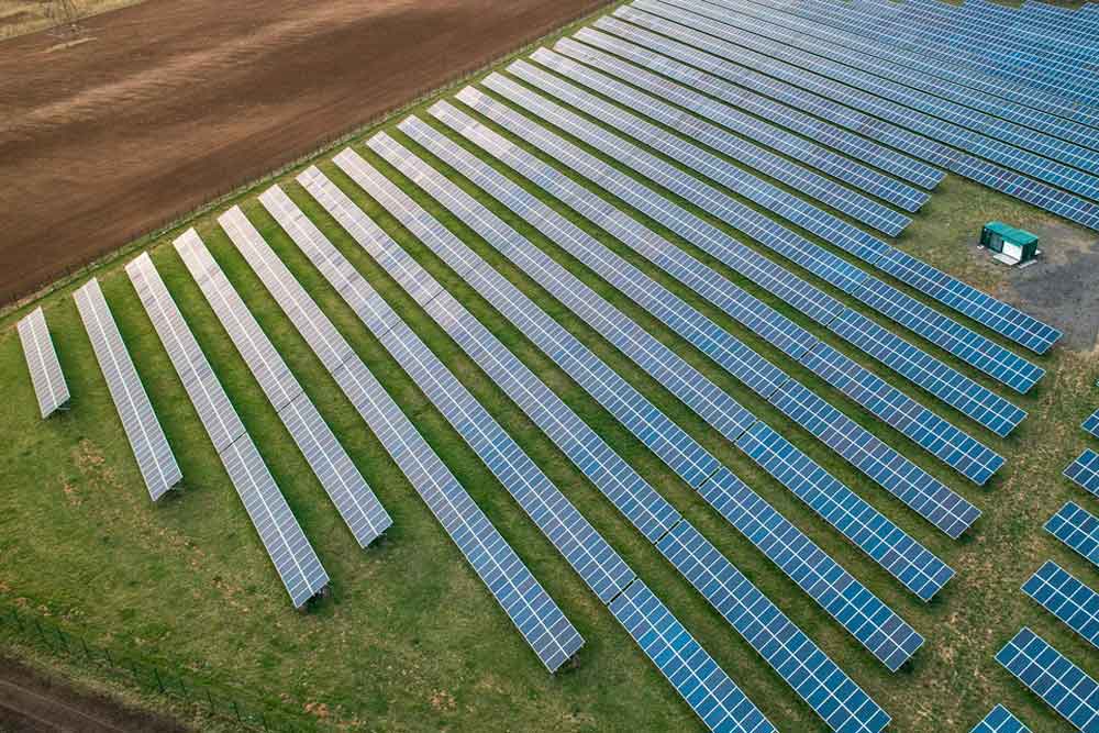
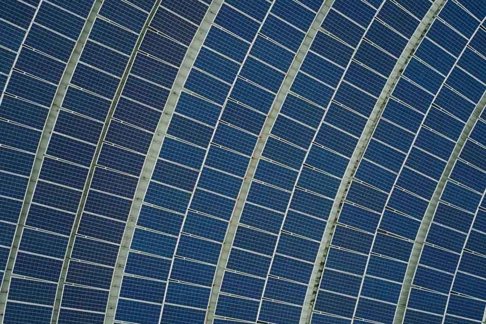
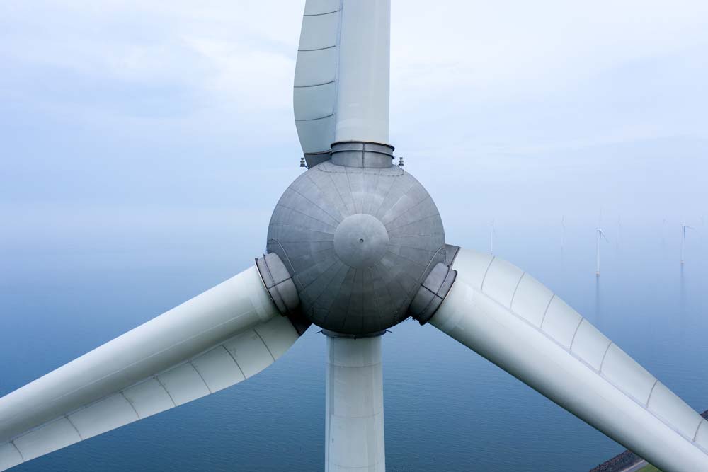
Thermal Solar Array Survey
Radiometric thermal mapping used to identify cell-level hotspots across 50+ hectare arrays. Delivering fault-prediction models that optimise renewable energy output.
Ready to Elevate Your Project Data?
Get In Touch
Discuss your survey specifications, thermal inspection needs, or construction monitoring requirements with our CAA-certified team. We provide transparent advice on workflows, accuracy tolerances, and safety compliance for projects of any scale.
Call Us
Monday–Friday, 9am–5pm
Visit Us
By appointment only