Specialist Rail Drone Surveying & Inspections
Safe, non-disruptive UAV data capture for rail corridors, structures, and HS2 infrastructure programmes.
UK Rail & HS2 Drone Solutions
Aerometrics supports HS2 and major UK rail programmes with specialist drone services that strengthen delivery, safety, and stakeholder communication. We capture survey-grade aerial perspectives across complex rail corridors, viaducts, and phased works, enabling Tier 1 contractors to monitor site change and report progress with absolute confidence.
From linear corridor photogrammetry to high-detail structural inspections, our workflows are engineered for rail environments and planned possessions. Our data is practical, repeatable, and built for long-term asset monitoring and BIM construction reporting.

HS2 Supply Chain & Contractor Delivery
As an active drone survey supplier for HS2, Aerometrics operates along complex rail corridors to deliver repeatable UAV coverage for construction sequencing and condition checks. Our team is fully site-aware, ensuring all flight operations align with stringent rail safety controls and NPH (Network Rail) operational constraints.
We provide high-resolution corridor updates and visual verification of completed works. By delivering engineering-grade media, we help project leads explain complex engineering stages to clients, funders, and local communities with clear, data-backed evidence.
Structural Monitoring & Linear Corridor Reporting
Critical rail infrastructure requires consistent, corridor-wide visibility. Our drone services support the monitoring of embankments, cuttings, and viaducts, capturing repeatable aerial evidence to detect structural movement, vegetation encroachment, or unplanned change.
Our flight schedules are meticulously planned to align with possessions and milestone reporting. Deliverables include orthomosaic maps, annotated inspection imagery, and change-detection visualisations that allow engineers to verify works and prioritise maintenance interventions before handover.

Rail & HS2 Data Intelligence
Survey-grade corridor mapping, structural integrity checks, and 4D progress evidence for Tier 1 rail delivery.
Case Study: Nine-KM HS2 Corridor Monitoring
Providing high-frequency visual oversight across a major section of the HS2 corridor, delivering consistent progress evidence for engineering leads and stakeholders.
Continuous Construction Oversight
Aerometrics manages ongoing aerial monitoring for a nine KM stretch of the HS2 rail corridor. Our mission is to provide "eyes on the ground" from the air, capturing repeatable, high-resolution visual evidence that helps delivery teams monitor site change over time.
By using consistent flight paths, we ensure that every update offers a direct comparison to previous weeks, allowing project managers to visualize earthworks, structural progress, and site setup across the entire work package without needing boots-on-ballast.
Key Delivery Outcomes
- Repeatable Corridor Views: Consistent framing for like-for-like progress reviews.
- High-Resolution Detail: Close-proximity monitoring of bridges, embankments, and cuttings.
- Stakeholder Transparency: Clear, professional media used for sponsor updates and community engagement.
- Reduced Trackside Risk: Aerial data capture reduces the need for manual site walkovers.
- Programme Verification: Visual records that support internal reporting on construction milestones.
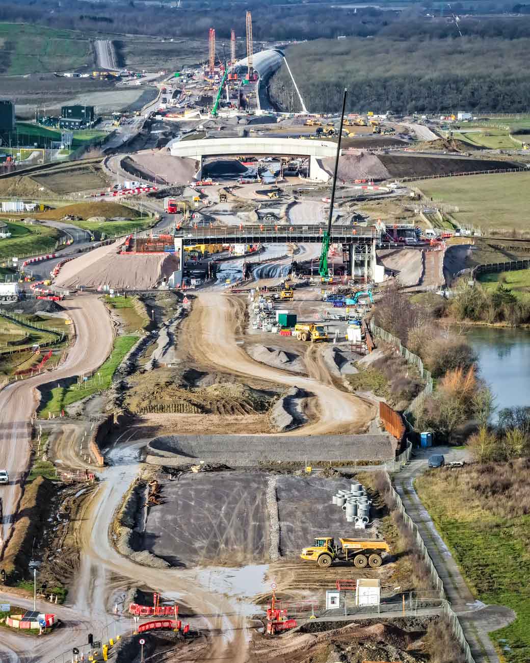
Integrated Rail Programme Monitoring
Get In Touch
Whether you're interested in our drone services or have questions about how we can help with your specific project, our team is ready to assist you.
Call Us
Monday–Friday, 9am–5pm
Visit Us
By appointment only