Drone Progress Monitoring
Consistent drone reporting that tracks change, verifies milestones and keeps stakeholders aligned
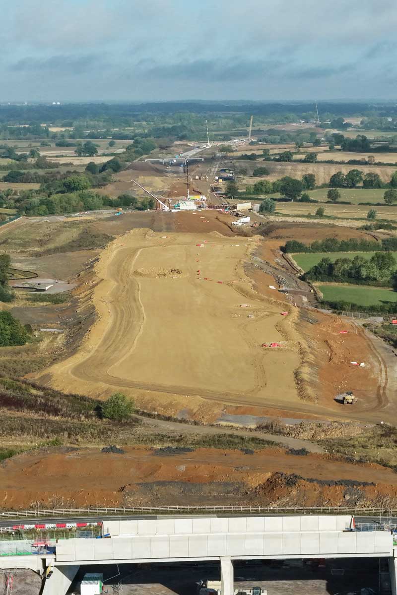
Progress Monitoring for Large-Scale Developments
Aerometrics delivers drone progress monitoring and reporting for major infrastructure and large-scale developments across the UK. We create clear, repeatable updates that help programme leads, contractors and client teams track change over time, evidence progress, and communicate status with confidence.
Each visit is captured to a consistent structure, using repeatable viewpoints and planned flight paths to support like-for-like comparisons between reporting periods. Outputs are produced for stakeholder updates, governance reporting and internal coordination, without disrupting live sites.
Whether you need weekly, fortnightly or monthly coverage, we match your reporting cadence and delivery rhythm. For longer programmes, pricing can reflect visit frequency, site scale and reporting depth, keeping sustained monitoring cost effective while maintaining high-quality deliverables.
Update Cadence & Dynamic Pricing
Large infrastructure and development programmes rely on consistent, repeatable progress monitoring. Aerometrics provides structured drone progress updates on weekly, fortnightly or monthly intervals, supporting long-term visibility across complex, multi-phase sites.
Our pricing scales with programme length, visit frequency, site footprint and reporting depth. High-frequency schemes such as linear infrastructure corridors, major transport works and large-scale developments benefit from volume-based rates, allowing close oversight without unnecessary cost escalation.
Flights are scheduled around key construction milestones, enabling clear phase tracking, proactive programme management and confident stakeholder reporting from initial groundworks through to final completion.


Progress Monitoring
Like-for-like drone captures with timelines, comparisons and change tracking for clear audit trails.
What Progress Reports Include
Aerometrics progress monitoring delivers consistent, like-for-like reporting across the full lifecycle of a project. Each report is built to support programme management, stakeholder communication and technical review, providing clear visual evidence of progress, sequencing and site condition at every stage.
- High-resolution aerial mapping showing site extents, access routes and newly completed works
- Phase-by-phase progress tracking across multi-stage infrastructure and corridor programmes
- Direct comparisons against previous site visits to identify change, delay or acceleration
- Annotated stills and video summaries highlighting key milestones, risks or approvals
- Timeline-based visuals designed for stakeholder briefings and decision support
- Export-ready assets suitable for dashboards, BIM environments and formal reporting packs
Phased Progress Tracking
Large infrastructure and development projects are delivered in defined phases, work fronts or corridor segments. Aerometrics progress monitoring breaks sites into logical sections, providing clear visibility of completed works, active construction and upcoming phases.
Each aerial capture is time-stamped and aligned to previous surveys, allowing straightforward comparison across reporting periods. This makes it easy to confirm programme alignment, identify emerging delays and validate when sections are ready for inspection, handover or stakeholder review.

Stay ahead of your project timeline
Get In Touch
If you are managing a live project and need consistent, reliable progress visibility, we can help. Speak to us about setting up a structured drone monitoring schedule aligned to your milestones, reporting requirements and stakeholder needs.
Call Us
Monday–Friday, 9am–5pm
Visit Us
By appointment only