Drone Thermal Imaging Surveys
UK-wide aerial thermal surveys for roofs, solar arrays and electrical assets, identifying heat loss, hotspots and anomalies with clear reporting.
Thermal Drone Surveys for Buildings and Infrastructure
Aerometrics delivers drone thermal imaging surveys that reveal heat loss, hotspots and defects you cannot see from the ground. Thermal capture is ideal when you need fast coverage of roofs, façades, solar installations or electrical infrastructure without scaffolding, shutdowns or intrusive access.
We supply practical outputs: annotated thermal imagery, location context and clear findings that can be used to prioritise repairs, verify remedial work and support audit trails. Where repeat surveys are required, we use consistent flight planning so results can be compared over time.
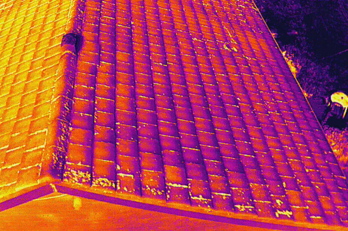
How We Capture Thermal Data
Flights are planned around the conditions that make thermal results meaningful, including time of day, weather and expected temperature contrast. This improves detection reliability across different materials and asset types.
Thermal imagery is paired with visible capture so findings are easy to locate and act on. Hotspots and anomalies are clearly marked and delivered with straightforward commentary, suitable for maintenance teams, stakeholders and reporting packs.
- Roof heat loss surveys and insulation defect detection
- Electrical hotspot identification and fault indicators
- Annotated thermal imagery and clear summary reporting
- Solar array thermal inspections for underperforming panels
Drone Thermal Imaging Applications
Practical thermal surveys that turn hotspots into clear, actionable findings.
Roof Heat Loss Surveys
Identify heat loss, insulation gaps and moisture patterns across roofs and building fabric. Ideal for planned maintenance, retrofit prioritisation and post-works verification.

Electrical and Mechanical Hotspots
Detect overheating components and abnormal temperature differences on electrical and mechanical assets, supporting early intervention before faults escalate.

Solar and Infrastructure Surveys
Thermal inspections for solar arrays and infrastructure to highlight underperforming areas, hotspots and anomalies that warrant closer investigation.
Supporting Application: Wildlife Surveys
Thermal can also support low-disturbance wildlife monitoring. For deer counting and conservation survey work, use the dedicated wildlife page.
Thermal Wildlife Surveys
Low-disturbance detection that supports deer counts and distribution mapping, particularly during dawn and dusk windows.
Deer Counting and Wildlife SurveysThermal Drone Survey FAQs
- What can a drone thermal imaging survey detect?
- Thermal surveys highlight abnormal temperature differences. Common findings include roof heat loss and insulation defects, moisture patterns, overheating electrical components, and underperforming areas on solar installations. Results are strongest when flights are planned for the right conditions and temperature contrast.
- How is thermal survey data delivered?
- You receive annotated thermal imagery with clear commentary, plus supporting visuals where needed so findings are easy to locate and act on. Outputs can also be supplied with location context suitable for reporting and asset records.
- Do weather and time of day affect results?
- Yes. Thermal performance depends on conditions. We plan surveys around suitable contrast and avoid scenarios that flatten readings, such as heavy solar loading or poor thermal separation, so the outputs are reliable and comparable.
- Can thermal surveys be combined with visual inspections or mapping?
- Yes. Thermal is often paired with high-resolution visual capture, mapping outputs or photogrammetry to add context and help pinpoint findings on complex assets.
Drone thermal surveys that highlight heat loss and hotspots
Get In Touch
If you need a drone thermal imaging survey, send the site location, asset type (roof, solar, electrical, infrastructure), and what you are trying to confirm (heat loss, hotspots, underperformance). We will advise on the best survey window and provide a clear plan and quote based on the deliverables.
Call Us
Monday–Friday, 9am–5pm
Visit Us
By appointment only