Drone Photogrammetry Services
High-detail 3D models, point clouds and measurements generated from aerial imagery for surveying, construction and heritage projects
High-Accuracy 3D Modelling from Drone Imagery
Aerometrics delivers professional drone photogrammetry across the UK, using structured, overlapping aerial imagery to reconstruct sites, structures and landscapes with high spatial accuracy. The result is a measurable digital record that helps teams plan, validate work and communicate progress without needing to be on site.
From heritage documentation and façade capture to construction modelling and infrastructure surveys, our photogrammetry workflows produce practical outputs such as dense point clouds, textured meshes, orthomosaics and measurement-ready imagery. Deliverables can be supplied for CAD and GIS use, or hosted in interactive viewers to support straightforward collaboration.
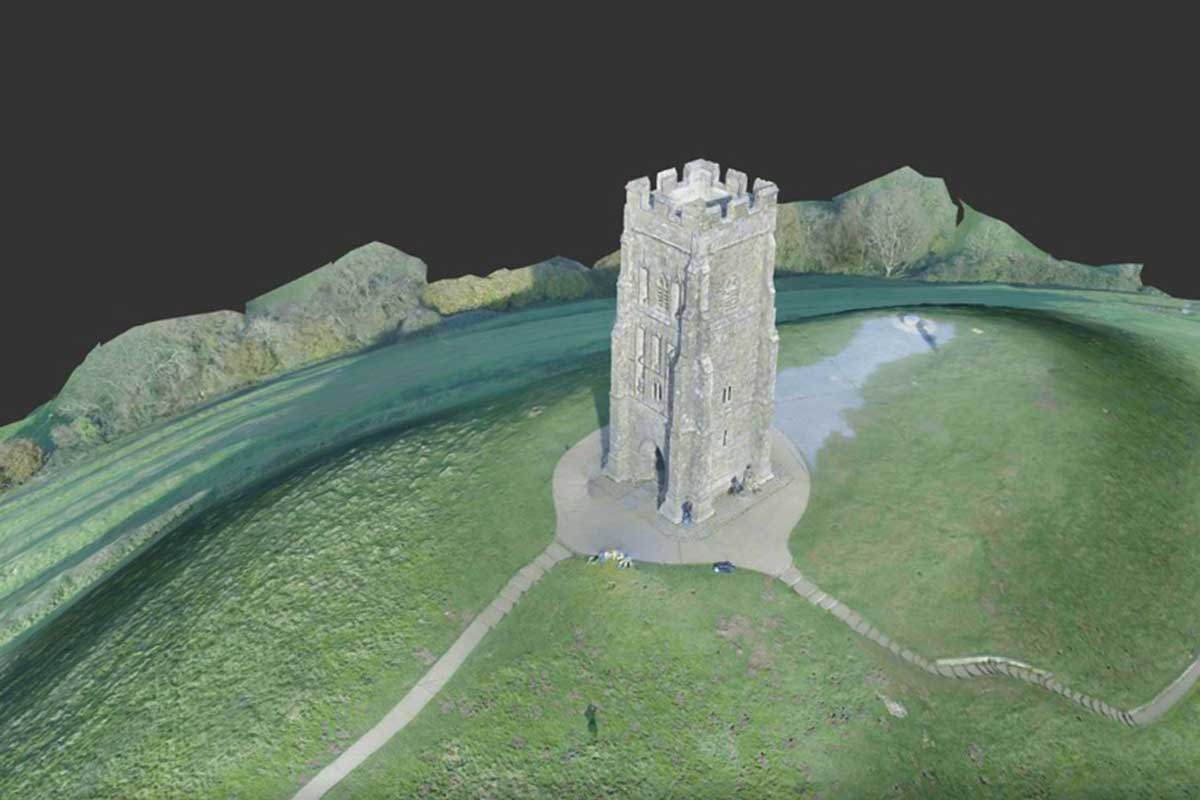
Dense Point Clouds and 3D Models from Photographs
High-quality 3D reconstructions can be created from hundreds of high-resolution aerial images, producing dense point clouds and textured models suitable for measurement, modelling and analysis. These outputs are widely used for conservation records, architectural documentation and engineering review.
We supply results in widely used formats so architects, engineers and survey teams can bring the data straight into existing workflows without friction.
Photogrammetry & 3D Modelling
Digital twins, dense point clouds and textured meshes generated from drone imagery.
Rapid Processing, Practical Outputs
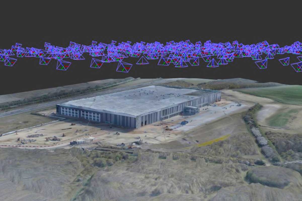
Using proven photogrammetry workflows, Aerometrics converts drone imagery into accurate 2D and 3D datasets with fast turnaround. For many medium-scale sites, initial deliverables are available within hours, supporting time-sensitive decision making.
Outputs include geo-referenced orthomosaics, dense point clouds and textured 3D meshes, ready for use in CAD, GIS and BIM environments. This allows teams to verify dimensions, review progress and retain a reliable digital record of sites and structures.
Frequently Asked Questions
- What level of accuracy can drone photogrammetry achieve?
- Accuracy depends on flight planning, camera resolution and ground control. Where ground control points are used, drone photogrammetry can achieve centimetre-level accuracy suitable for surveying, engineering review and design validation.
- Which industries typically use photogrammetry?
- Photogrammetry is widely used across construction, heritage conservation, land management, infrastructure, environmental monitoring and asset documentation where reliable spatial records and measurements are required.
- What deliverables are provided?
- Deliverables include orthomosaic maps, digital elevation models, dense point clouds and textured 3D models. Data can be supplied in CAD, GIS or BIM-compatible formats, depending on project requirements.
- How quickly can results be delivered?
- For small to medium sites, processed outputs are often available within 24 hours. Larger or more complex sites may require additional processing time depending on scale, resolution and output type.
Turn drone imagery into usable 3D data
Get In Touch
Whether you're interested in our drone services or have questions about how we can help with your specific project, our team is ready to assist you.
Call Us
Monday–Friday, 9am–5pm
Visit Us
By appointment only